These two acronyms are manufacturer defined and refer to the same process. The equipment may vary by manufacturer, but suffice it to say the process is the same and therefore the results will be the same.
International Inspection has both varieties of equipment and can handle your requirement in this area.
The GPR Process
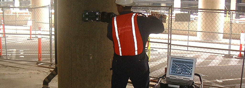
1. Upon arrival to the project site we perform a complete walk through with the client to verify areas of interest and to determine if 3D is possible with available scan area. 2. We setup the equipment and perform a “reconnaissance“ scan to quickly identify concrete depth and calibrate the system. If 3D scan is not required or possible, we mark all indications found during this process with paint stick.
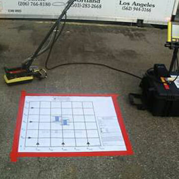
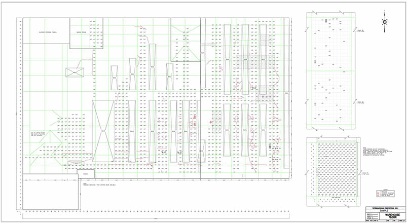
3. For 3D scanning, we then setup the area to be scanned by placing a grid sheet for either 24“ x 24“ or 48“ x 48“ scan areas. For larger scan areas, grids area laid out by snapping chalk lines.
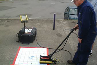
4. We acquire the data per the grid sheet, process the data and review 1“ of depth at a time through the entire slab.
5. We then mark on the grid sheet or on the slab the indication location and approximate depth (within 1 inch).
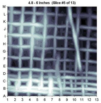
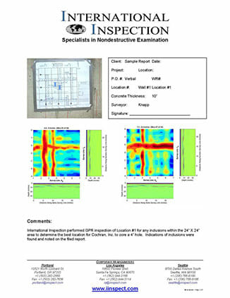
Sample GPR Report
Should your project require a report we can either process and send the data in formal report format, email it to your desired contacts, or save the data to CD for your archives.